
25 January 2022
(Updated 28 January: added Ottawa etymology and Goddard citation.)
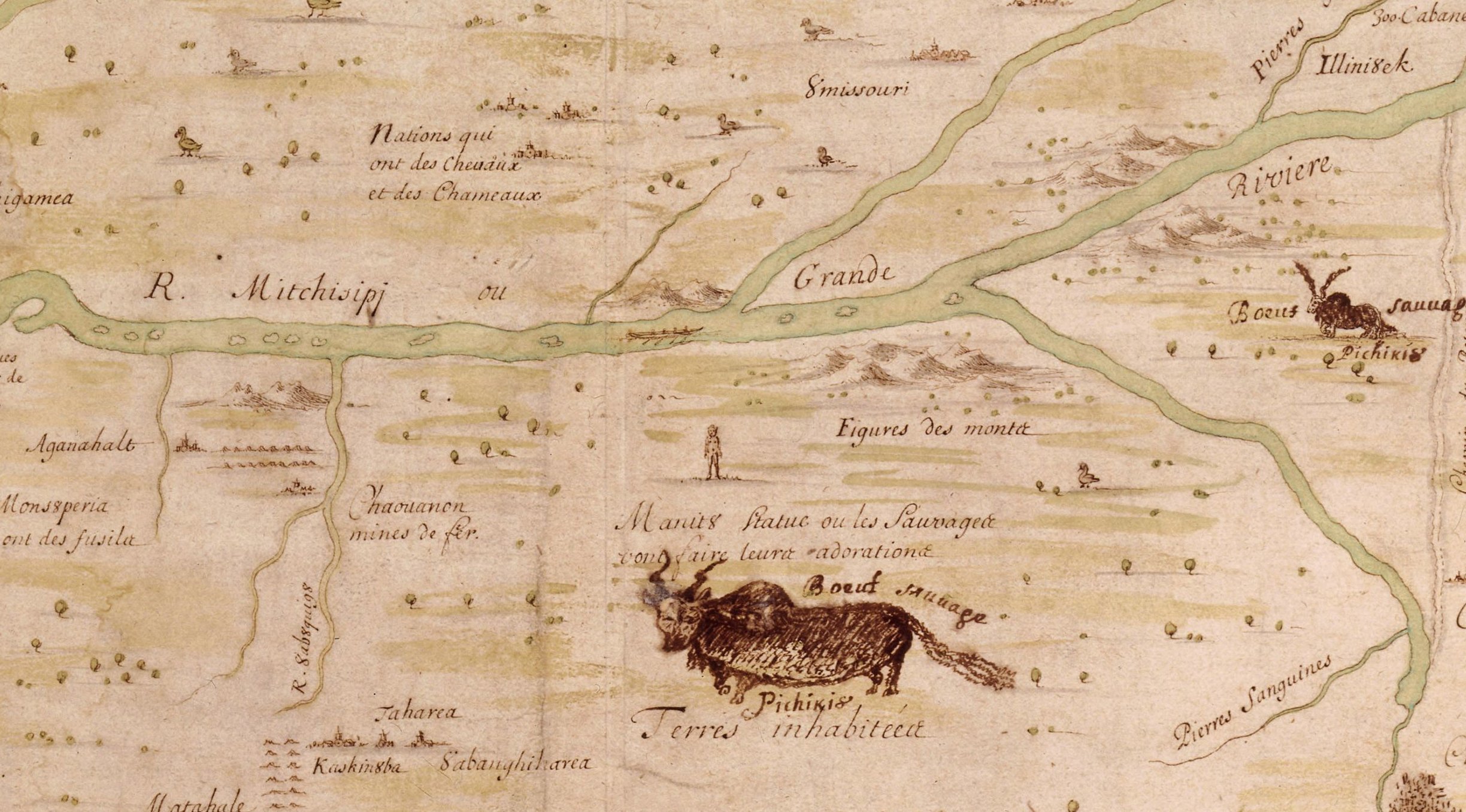
Detail of a 1673 map by Jacques Marquette showing the Mitchisipi River. A hand-drawn map of a large river showing Indigenous settlements on both banks.
The state of Mississippi has an Indigenous name, but not one from a language of the peoples who lived there at the time of European contact. Those people primarily spoke Muskogean languages, while the name Mississippi is from the Algonquian language group, most likely from the Ottawa missi-si·pi (large river). The state takes its name from the Mississippi river, which forms its western border. The name of the river entered into European languages via French explorers far to the north of what is now the state, near the river’s headwaters, hence the belief that it comes from Ottawa.
The name Mississippi, for the river, appears as Mitchisipi in a 1673 map by Jacques Marquette. It makes its way into English by 1698 in a translation of Henri de Tonti’s Account of Monsieur de la Salle’s Last Expedition and Discoveries in North America:
This Bay of Puans is formed by an overflowing of the Lake of the Illinois, occasion’d by a great River, which falls into this Lake. This River call’d Onisconcing comes from another Lake about 100 Leagues distant; from which comes another River, which falls into the Mississipi; and therefore this Lake may be lookt upon as a Communication between Canada and the Gulph of Mexico, as one may see by the Map.
The colonial masters of the region that is now the state of Mississippi changed several times over the course of the eighteenth century. Originally claimed by France, the region was ceded to Britain from France following the French and Indian War (Seven Years’ War). It was subsequently ceded to the United States following the American Revolution, which organized the Mississippi Territory in 1798, consisting of what is now the states of Mississippi and Alabama. The western half of the territory was admitted to the union in 1817 under the name Mississippi, and the eastern half was redesignated Alabama.
Sources:
Bright, William. Native American Placenames of the United States. Norman: U of Oklahoma Press, 2004.
Everett-Heath, John. Concise Oxford Dictionary of World Place Names, sixth ed. Oxford: Oxford UP, 2020. Oxfordreference.com.
Goddard, Ives. “Mississippi.” Society for the Study of the Indigenous Languages of America, Newsletter 25.4, January 2007, 12–13. Archive.org.
Marquette, Jacques. Map of the New Discovery Made by the Jesuit Fathers in 1672. 1673. Library of Congress.
Tonti, Henri de. An Account of Monsieur de la Salle’s Last Expedition and Discoveries in North America. London: J. Tonson, et al. 1698, 24. Early English Books Online.
Image credit: Marquette, Jacques. Map of the New Discovery Made by the Jesuit Fathers in 1672. 1673. Library of Congress. Public domain image as a mechanical reproduction of a public domain work.