
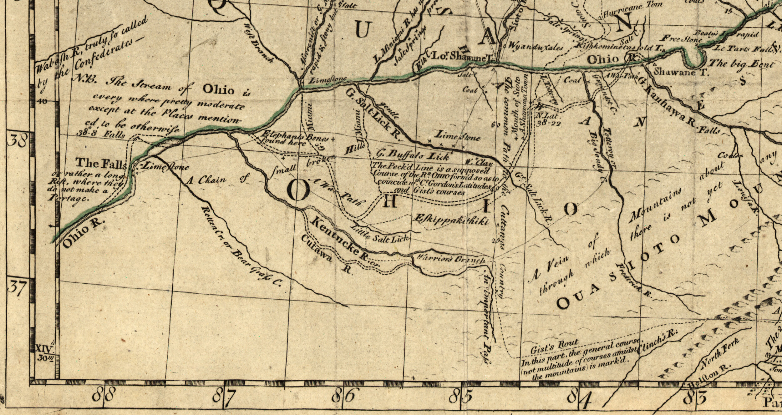
Detail of a 1755 map showing the Kentucke River
1 June 2021
Kentucky is another of those North American place names that comes from an indigenous word but which word and what it means is uncertain. There seem to be two leading possibilities. The first is that it was the name of a Shawnee (Algonquian) village in what is now Clark County, Kentucky, Eskippakithiki. The second is that it is a Wyandot (Iroquoian) word meaning “plain, meadowland.” The Wyandot word in question was likely similar to the Seneca (another Iroquoian language) gȩdá’geh, pronounced /kẽtaʔkeh/ and meaning “at the field.”
The earliest English-language use of Kentucky that I have found hints at the Shawnee origin, although it places the location at some distance from the Shawnee settlement. From the Pennsylvania Gazette, 10 May 1753:
By Letters from Virginia, dated the 10th of April, we have the following Advice, viz. “That an armed Company of Indians, consisting of Ottowawas, and Connywagas, headed by one of the Six Nations, and a white Man, met with some Pennsylvania Traders, at a place called Kentucky, about 150 Miles from the Shawnese Town, on this side of the Allegheny River, and took eight Prisoners, five belonging to Mr. Groghan, the other three to Mr. Lowry, and with them Goods to the Value of upwards of Three Hundred Pounds.
Kentucky is also the name of a river, and this is first recorded in English in 1755 in a description and map of the middle British colonies by Lewis Evans and published by Benjamin Franklin:
KENTUCKE || is larger than the foregoing, has high Clay Banks, abounds in Cane and Buffaloes, and has also some very large Salt Springs. It has no Limestone yet discovered, but some other fit for building. Its Navigation is interrupted with some Shoals, but passable with Canoes to the Gap, where the War Path goes through the Ouasioto Mountain. This Gap § I point out in the Map, as a very important Pass; and it is truly so, by Reason of its being the only Way passable with Horses from Ohio Southward for 3 or 400 Miles Extent. And if the Government has a Mind to preserve the Country back of Carolina, it should be looked to in Time.
We get references to Kentucky as a place settled by white people by 1776. A notice placed in the Virginia Gazette on 23 August 1776 says the following:
KENTUCK, August 21, 1776.
WHEREAS, in consequence of an agreement made between myself and mr. John Floyd of this settlement, about a piece of land, I gave the said Floyd my bond for 20 l. I therefore give this publick notice, that I will not pay but half the same, and that whoever may take an assignment of the said bond for more than 10 l. will certainly be disappointed of their expectations therein.
1 || JOHN MAXWELL.
Kentucky was incorporated as a county of Virginia in December 1776. Petitions for statehood began in 1778, and on 1 June 1792 Kentucky became the fifteenth state of the United States.
Sources:
Advertisement, Virginia Gazette (Williamsburg), 23 August 1776, 3. Readex: America’s Historical Newspapers.
Bright, William. Native American Placenames of the United States. Norman: U of Oklahoma Press, 2004.
Evans, Lewis. Geographical, Historical, Political, Philosophical and Mechanical Essays. The First Containing an Analysis of a General Map of the Middle British Colonies in America. Philadelphia: B. Franklin and D. Hall, 1755, 29, 37. Eighteenth Century Collections Online (ECCO).
Everett-Heath, John. Concise Oxford Dictionary of World Place Names, sixth ed. Oxford: Oxford UP, 2020. Oxfordreference.com.
McCafferty, Michael. Native American Place Names of Indiana. Urbana: U of Illinois Press, 2008, 250. Google Books.
“Philadelphia, May 10.” Pennsylvania Gazette (Philadelphia), 10 May 1753, 2. Readex: America’s Historical Newspapers.
Image credit: Lewis Evans, 1755, Map of the Middle British Colonies in North America. Library of Congress. Public domain image.